If you are one of the 16 million French hiking enthusiasts, you certainly need an adapted GPS to orient yourself. With so many models to choose from and so many criteria to keep in mind, the choice is not always easy. To simplify your task, take a look at our favorite, the Garmin eTrex Touch 35. This hiking GPS attracts by its practicality, its cartography and its price.
Here is our commitment, to make sure that we provide the best user experience and content quality:
You can support us by using our links to make your purchases (at no extra cost to you)! This sometimes earns us a commission which allows us to remain independent. More about us
Our selection
"The Garmin eTrex Touch 35 stands out from other hiking GPS units for its mapping, performance and reliability. In addition, the battery life reaches 16…"
"The Garmin eTrex 10 offers the essential features while being rugged and reliable. Despite its monochrome and low resolution, it is one of the easiest…"
"The Garmin Oregon 750t is packed with features. It is as pleasant to use as it is powerful, and is suitable for hiking in difficult…"
"Robust and pleasant to use, the Garmin eTrex 32x is a GPS designed for adventure. The device has a barometric altimeter and an ANT+ connection."

The Garmin eTrex Touch 35 stands out from other hiking GPS units for its mapping, performance and reliability. In addition, the battery life reaches 16 hours.
190 £ on AmazonSimilar to a small smartphone, the Garmin eTrex Touch 35 has a simple and intuitive navigation system. This hiking GPS is also suitable for other outdoor activities such as camping, trekking, mountaineering ... With friends, family or solo, you will not get lost with this device.
With the Garmin eTrex Touch 35, enjoy the TopoActive topographic map of all of Europe. In addition, you will have 250,000 virtual treasure hunts at your disposal. Finally, its 2.6-inch capacitive touch screen, bike mount, barometric altimeter, electronic compass, great compatibility and USB connectivity will surely leave you wanting more.

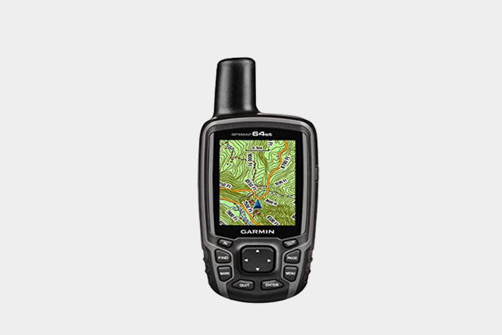
The Garmin eTrex 10 offers the essential features while being rugged and reliable. Despite its monochrome and low resolution, it is one of the easiest to use.
See priceWith its high-sensitivity sensors and preloaded global mapping, the Garmin eTrex 10 hiking GPS can calculate your position quickly. It's just as effective whether you're in a wooded area or deep in a valley. It's compatible with both GPS and Glonass systems and features simple, intuitive menus. In addition, the eTrex 10 offers virtual treasure hunts.
We appreciate the fact that this hiking GPS provides information on the characteristics and difficulties of the terrain practiced while giving practical tips. Its 2.2-inch monochrome display is easy to read, even in bright sunlight. For your leisure, the eTrex 10 offers Basecamp and point-to-point navigation. And it's IPX7 waterproof.

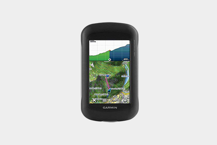
The Garmin Oregon 750t is packed with features. It is as pleasant to use as it is powerful, and is suitable for hiking in difficult areas.
366 £ on CdiscountGarmin has done it right with the Oregon 750t, a hiking GPS that keeps you safe on your adventures. Thanks to its dual GPS and Glonass systems, you can navigate safely, even over steep terrain. Note that it's preloaded with TopActive Europe mapping. You can add more, given the 8 GB of internal memory available, plus a port for micro SD card up to 32 GB.
The device has other essential sensors such as barometric altimeter, 3-axis compass and GPS compass. For ease of use, this hiking GPS uses a 3-inch, dual-orientation, anti-glare color touchscreen. AND with Smart Notification and wireless connectivity, receive your texts and calls directly on your GPS.

Robust and pleasant to use, the Garmin eTrex 32x is a GPS designed for adventure. The device has a barometric altimeter and an ANT+ connection.
See priceThe Garmin eTrex 32x hiking GPS will keep you on course and allow you to move forward in difficult environments. Indeed, it is compatible with the 2 navigation systems: GPS and Glonass. It also has a barometric altimeter, a 3-axis electronic compass with tilt compensation and a GPS compass.
Preloaded with the TopoActive Europe maps of trails and roads, it is also suitable for cycling and trekking. In terms of comfort, its 2.2-inch transflective 240 x 320 pixel screen with 65,000 colors offers very good readability. Note that it has an internal storage of 8 GB expandable by optional micro SD card. Finally, the eTrex 32x is IPX7 certified with a battery life of 25 hours.
Any specific needs?
The best entry-level hiking GPS
The best hiking GPS in terms of battery life
Your guide :
Rate this buying guide :By rating this buying guide, you are helping us to reward our best writers. Thank you!
| TOP OF THE TOP | CHEAP | TOP OF THE LINE | EXCELLENT | |
|
In accordance with our commitment, this buying guide does not contain any sponsored products. |
9/10 |
7/10 |
9/10 |
7/10 |
| OUR SELECTION |
Garmin eTrex Touch 35
|
Garmin eTrex 10
|
Garmin Oregon 750t
|
Garmin eTrex 32x
|
|
The Garmin eTrex Touch 35 stands out from other hiking GPS units for its mapping, performance and reliability. In addition, the battery life reaches 16 hours.
|
The Garmin eTrex 10 offers the essential features while being rugged and reliable. Despite its monochrome and low resolution, it is one of the easiest to use.
|
The Garmin Oregon 750t is packed with features. It is as pleasant to use as it is powerful, and is suitable for hiking in difficult areas.
|
Robust and pleasant to use, the Garmin eTrex 32x is a GPS designed for adventure. The device has a barometric altimeter and an ANT+ connection.
|
|
|
|
Custom Map function
|
Pack of 20 AA 1.5V alkaline batteries included in delivery
|
Many interesting features: dynamic weather, wifi...
|
Durable and waterproof
|
|
|
Accurate barometric altimeter
|
Anti-corrosion materials to increase its life span
|
8MP sensor
|
Up to 25 hours of battery life
|
|
Type
|
GPS compass
|
Ideal for beginners
|
Hunting and fishing calendar and LED flashlight included
|
Very good battery life
|
Help us improve this table:
Report an error, request the addition of a feature to the table, or suggest another product. Thank you for your kindness!
We spend thousands of hours each year studying the major specialized websites, analyzing products of hundreds of brands and reading user feedback to advise you on the best products.
We are a product review company with a single mission: to simplify your buying decisions. Our research and testing helps millions of people every year find the best products for their personal needs and budget.
To support us you can: use our links to make your purchases (which often earns us a small commission), share our articles on social networks, or recommend our site on your blog. Thanks in advance for your support!
To ensure the quality of your hiking GPS, you should check its satellite reception, as this is what it was originally designed for. On that note, models equipped with GPS, Glonass, or HotFix receivers stand out, ensuring good coverage in difficult areas.
Hikers typically traverse all types of terrain in all kinds of conditions. Ruggedness is the name of the game with most models dedicated to hiking. Unlike the so-called "mixed" models, they are the result of a manufacturing process that takes into account the main hazards of the discipline. Among them, we note the bad weather, snow, or a heat peak. Shock resistance must also be considered when it comes to hiking GPS. It is best to choose devices that comply with IPX standards, which correspond to a high level of waterproofing. They can continue to function even when submerged at a depth of 1 m for 30 min.
Mapping also counts among the criteria for choosing a good hiking GPS. Most hiking GPS units come with preloaded geocaches or preloaded topographic maps. For optimal convenience, versions that offer the possibility of adding digital backgrounds at 1:10,000 and downloadable digital tiles at 1:25,000 are preferred. Notorious backpackers also appreciate those giving precise and detailed indications on the main must-see places of a city or a region.
The price of a hiking GPS can vary depending on the features available. For example, it is possible to pay less for a GPS without a preloaded map or barometer. However, some models do not offer this choice.
The
autonomy is also a determining criterion of choice, in terms of hiking GPS. Indeed, during a day of hiking, the device is requested up to 6 to 8 hours
. An entry-level model rarely exceeds 5 hours of autonomy. On the other hand, the 50-hour mark is reached in the high-end category. Important: the autonomy displayed on a hiking GPS often corresponds to the standby mode.
When buying a hiking GPS, it is also worth paying attention to the screen. Its size can, for example, affect the level of readability. On this same point, it is also better to prefer a transflective screen. Its brightness varies according to the sun's reflection, for maximum readability. For their part, Nordic walking enthusiasts will certainly aspire to a touch screen compatible with gloves, which are very useful in winter. While buttoned units have the advantage of allowing longer use regardless of weather conditions, despite a proven slowness.
The compass is one of the key functions of a hiking GPS. It allows hikers to keep the north in their movements. Some GPS models offer an electronic compass that is very handy for indicating directions, but also in which direction you are when you are stationary.
When buying a hiking GPS, it is also best to make sure that the device offers a barometric altimeter, a valuable tool in navigation. A calibration shot on each outing allows for great accuracy in terms of altitude indications.
Additional functions make high-end hiking GPS a true multi-function device. Indeed, in addition to the basic features, they offer a camera, and even a feature to communicate the route directly on social networks. Smart notification and wireless data transfer allow your GPS to communicate with compatible GPS units. Additional features make high-end hiking GPS a true multi-purpose device. In fact, in addition to the basic features, they offer a camera, and even a feature that lets you share your route directly on social networks. Smart notification and wireless data transfer allow your GPS to communicate with compatible GPS units.
It is primarily a GPS, but dedicated to hikers or cyclists. The abbreviation GPS comes from "Global Positioning System" which means Global Positioning System. A hiking GPS or leisure GPS works on the same principle as a conventional GPS.
The device receives signals from several satellites and calculates the user's position using the triangulation method. This is essentially based on the distance between the device and each satellite. Currently, the accuracy of an individual GPS is between 5 and 10 meters.
Initially created for the U.S. military and controlled by the U.S. government, GPS has become a multipurpose global system. It is used in maritime navigation as well as to facilitate road traffic.
GPS is also very useful for hikers. Indeed, going on a hike is not improvised at the risk of getting lost on the way. You need a GPS for hiking to :
In short, a dedicated hiking GPS is ideal if you go out regularly and over a longer distance. It allows you to secure your journey and saves you precious time. Its ruggedness also makes it a faithful partner that won't abandon you no matter what the circumstances.
Europe has planned to create its own system called Galileo, which is scheduled to be launched in 2020. Galileo is even more accurate than its American equivalent, but it is not yet integrated into all mobile devices. Nevertheless, there are many "GPS" devices that are compatible with Galileo.
GPS hiking devices with buttons are more robust. That means they're more durable. You can use them for years. In addition, these tools are shock resistant. Temperature change is not a problem for its proper functioning. Since the buttons take up more space, the screen size is smaller. This does not hinder the reading of information. However, it takes longer to display the information. In any case, the buttons are easy to manipulate even when wearing gloves. If you're willing to sacrifice the aesthetics of the tool, then the button GPS is a good compromise for any situation.
More stylish, more intuitive, quite modern, touchscreen hiking GPS units are just as popular with walkers. They have the appearance of a smartphone. This appearance seduces buyers more than the technical features. Nevertheless, the latter should be considered more since the performance of the device depends on it. The comfort of use can be optimal if the weather is good. However, it is reduced when it rains. The screen is no longer operational in this condition. You will also have difficulty using it in cold weather. The screen is less receptive, if at all, when you wear gloves. Fortunately, the display is in color with a much higher visual quality despite the sun's rays. One last thing to note: the battery life of a touchscreen hiking GPS is limited.
The hiking GPS is a device specially designed to help you locate yourself in the mountains and wherever you are. Its navigation system can offer breathtaking accuracy that is very useful when you are in very remote places.
The hiking GPS can also incorporate additional tools such as an electronic compass or a barometric altimeter. These tools help you to locate yourself even better. The hiking GPS is powered by replaceable batteries with a battery life of up to 15 hours. The information is displayed on a screen that is less than 3 inches in size and can be touch-sensitive or not.
Smartphones are increasingly used for orientation. Many mobile applications use the various geolocation technologies that are available to users. An Internet connection is generally required to access all the features, although it is possible to pre-save maps and routes.
The display is on the phone's large screen and there are many features that can be used. On the other hand, mobile applications do not always offer geolocation data with great accuracy. Moreover, their use is limited by the autonomy of the smartphones on which they are installed.
While using a smartphone may be more comfortable in terms of display, it does not allow for the most accurate navigation. You also need an Internet connection to take full advantage of its features. You can therefore use it in town to find your way around. On the other hand, when you go hiking in a place without a connection, the hiking GPS remains more reliable.
It provides you with highly accurate information and can provide you with tools to help you find your way. This more than makes up for the poorer quality display than a smartphone. GPS units are generally more robust than smartphones, making them more suitable for those outings that take place in sometimes difficult conditions. In addition, GPS hiking devices have a longer battery life than smartphones.
The hiking GPS is the most compact of the GPS. It has many advantages:
Make the most of your adventure with a very practical and reliable device. Hiking, trekking, biking... you'll find your satisfaction is increased tenfold if you bring a quality hiking GPS.
The hiking GPS offers multiple advantages to its user, being a real companion on the road. Although not all hiking GPS units offer navigation functions, they will be a great help in finding your way around.
Those who like a challenge will also find happiness with this device that can record all the routes. This way, you have the possibility to review and save your hike for a future game.
A hiking GPS is meant to be simplistic. Everything is designed to make it easy to use: as few buttons as possible, touch screen, extra large screen... We also note the waypoints (track) which are a great help for navigation. In addition, the development of routes is very intuitive on a GPS hiking. It's child's play and can be done in no time.
A quality GPS can replace the map and save you the tedious task of reading, folding and unfolding it all the time. It can even be more convenient than the map by being more compact and practical. All you have to do is copy a file in GPX format into the GPS that indicates the part that contains the tracks and waypoints you were planning to make. In recent times, hiking GPS units have also been enhanced with precise and detailed information on the most important places in the area, making them even more practical.
The screen of a hiking GPS also offers optimal readability. To get the most out of it, simply opt for a device with a large screen. Choosing a transflective screen can also pay off. In most cases, readability is guaranteed by a system designed to vary the brightness according to the angle of the sun. In the category of touch screens, it is better to choose those compatible with gloves, to simplify the task in winter.
Top-of-the-range hiking GPS units are multi-functional. For example, they are equipped with a camera, a thermometer, a compass and a barometric altimeter. At a time when sharing photos on social networks has become an international sport, some manufacturers have also added a feature that allows you to share your route directly with your friends and followers.
Many high-end hiking GPS models offer a full version of a barometric altimeter. This is a valuable navigation aid for mountain trekkers. At any given moment, they can indeed know the exact altitude, provided that they make a calibration on each outing.
Robustness is one of the advantages of a true hiking GPS, setting it apart from a simple smartphone. When designing the device, many manufacturers take into account the hazards of the discipline, such as bad weather, snow, or a heat wave. Since hiking is often associated with the risk of shocks, the shells of a hiking GPS are reinforced. In addition, the major brands offer devices that comply with IPX standards. A label that corresponds to a high level of waterproofing.
The autonomy contributes to the practicality of a hiking GPS. It is best to avoid entry-level devices that generally only offer 5 hours of autonomy. In fact, during a full day, hikers can walk for 6 to 8 hours. A high-end device offers up to 50 hours of autonomy. It is thus addressed to the unconditional ones of pedestrian excursions being spread out over several days.
In our opinion, the best brands of Hiking GPS in 2022 are :
Garmin is the world leader in satellite navigation equipment and systems. Its products are built to last, yet are powerful and fun to use.
Founded in 2001, TwoNav is a Spanish brand specialized in software for extreme sports. The brand then launched its own range of GPS navigation devices.
Suunto is a Finnish manufacturer of measuring instruments for sports, such as compasses, barometers and multifunctional GPS watches. It is known for the quality of its products.
Since its creation in 1977, the Polar brand has been producing and marketing high quality GPS trackers and heart rate monitors. Despite a market dominated by large firms such as Apple and Garmin, Polar stands out thanks to the great autonomy and scalability of its products, including the hiking GPS.
The diagram below will help you to get an idea of the typical prices for each price range (entry-level, mid-range and high-end).
However, more expensive does not necessarily mean better.
We therefore advise you to always consult our ranking before deciding, rather than blindly relying on price ranges.
Turn on your GPS 15 minutes before departure
It takes about 15 minutes for the GPS to receive navigation signals from the satellites. That's why you should start it up fifteen minutes before you leave.
Empty the active memory and delete the records you no longer need
To
make recording and sorting easier, consider emptying your GPS's active memory and cleaning its storage system
.
Make sure your GPS stays in the open or mount it on the handlebars of your ATV
A
GPS must be able to receive satellite signals properly, so it must be well exposed
.
Bring a spare battery or batteries
Make sure
you have batteries or a backup battery to deal with any unforeseen events, and make sure they are easily accessible
.
Dim the screen backlight to save battery life
Turn down the
backlight brightness level to maximize your GPS's battery life
.
The best hiking GPS depends on your needs and budget. Read our buying guide to find out which products are best.
The signals received give information on the real time position, time and speed of the hiker.
Depending on the model, the autonomy ranges from 16 to 25 hours.
If your GPS has plenty of storage and a slot for a better SD card, you can download additional maps.
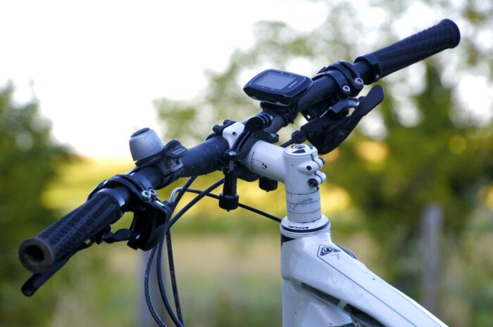
Most touring GPS units can be used for cycling. Simply attach your GPS to the handlebars with an optional mount.

Every month we help more than 1 000 000 people buy better and smarter.
Copyright © 2022 - Made with ♥ by buyingbetter.co.uk
Your reviews and buying guides 0% advertising, 100% independent!